All Jharkhand Competitive Exam JSSC, JPSC, Current Affairs, SSC CGL, K-12, NEET-Medical (Botany+Zoology), CSIR-NET(Life Science)

SIMOTI CLASSES

Education Marks Proper Humanity

SIMOTI CLASSES

Education Marks Proper Humanity

SIMOTI CLASSES

Education Marks Proper Humanity

SIMOTI CLASSES

Education Marks Proper Humanity

SIMOTI CLASSES

Education Marks Proper Humanity

Showing posts with label JH-GEOGRAPHY-E. Show all posts

Saturday, September 11, 2021

Hot Spring of Jharkhand- JPSC/ JSSC/ PSC

Hot Spring of Jharkhand

Many hot water bodies are found in Jharkhand. Where there is an intersection of the groundwater level and the surface, the water of the earth starts coming out, which is called 'hot springs'.

  • Charakkhudra: 10 km from Tundi on Dhanbad-Giridih Road
  • Tetulia: Dhanbad
  • Kava: Hazaribagh 
  • Tatapani: Latehar
  • Dauri: Chatra
  • Jahripani: Dumka
Hot Spring of Jharkhand
  • Tapatpani: On the banks of More river near Kumrabad in Dumka
  • Nunbil: Near Kenalguta Dumka
  • Baramasia: Pakur
  • Ranibahal: On the banks of More river in Ranibahal on Dumka-Suri road
  • Jhumka: On the banks of More river near Ranibahal
  • Shivpur Sota: Pakur
  • Ladla Udah: Pakur.

Share:

Wednesday, September 1, 2021

Gondwana System (Mesozoic Era): Geological Structure of India

Gondwana System

The 'Mesozoic'= middle life. The term is used for a period of geologic time in which the presence of fossil invertebrates dominated the rocks.

The Mesozoic Era includes three periods: Triassic, Jurassic, and Creatceous.

In the Geological Scale Time Scale, these periods extend from the Upper Carboniferous up to the beginning of the Cenozoic Era or the Aryan Era.

The term 'Gondwana' was covered by H.B. Medicott in 1872. It was derived from the ancient tribe of Gonds that inhabits the central provinces of Madhya Pradesh.

The Gondwana formations are fluviatile and lacustrine in character. They were deposited in the river basins and lakes during the Upper Carboniferous Period. These basins later subsided along the trough faults amidst ancient rocks of the great southern continent called the Gondwanaland. These rocks were formed during the Upper Carboniferous and the Jurassic Periods (Mesozoic Era).

The Gondwana group begins with the Permo-Carboniferous period, which, in the Standard Geologic Time Scale, is known as a period of coal formation. The lower Gondwana rocks are found in;

1. Talcher series: 

  • It is the series of the Gondwana system named after Talcher in Dhankenal district of Odisha.
  • Talcher coalfield has the highest coal reserves in India of 38.65 billion tonnes. This coalfield is divided into five (5) production areas namely- Talcher, Jagannath, Kalinga, Lingaraj, and Hingula.
  • The industries in Talcher are located along the river Brahmani which flows from the northwest (NW) to southwest (SW).

2. Damuda series:

  • The important coal-bearing areas of this period are- Raniganj, Jharia, Karanpura, and Bokaro of the Damodar basin, Singrauli, Korba, and Pench Valley (Chattisgarh and Madhya Pradesh), Talcher (Mahanadi Basin, Odisha), and Singareni (Satpura Basin, Madhya Pradesh).
  • The Jhingurda Coal Seam with a thickness of about 131 m is the thickest in India.

3. Panchet series:

  • It is the youngest series of the Lower Gondwana System, which derives its name from the hill of that name, south of Raniganj. 
  • The series consists of greenish sandstone and shales. It is, however, devoid of coal-seams.
  • The iron-ore shales of the lower Gondwana system are particularly well developed in the Raniganj coalfields (West Bengal). However, they contain inferior quality iron ore, i.e., sindrites and limonite. Being inferior in quality, they are generally not mined for iron. 

Gondwana System (Mesozoic Era): Geological Structure of India

The Gondwana System of rocks provides over 95% of the coal of India
Most of the good-quality coal deposits (bituminous and anthracite) of India are found in Gondwana formations. Moreover, iron ore occurs in the iron-stone shales of Raniganj coalfields. In addition to coal and iron, kaolin, fire-clay, sandstone, and grits are found in the Gondwana formations. 

The Gondwana rocks are also found in the Himalayas from Kashmir to Arunachal Pradesh and Poorvanchal. The coal seams of these areas are metamorphosed. They are also found in Saurashtra, Kachchh, Western Rajasthan, Coromandal Coast, and Rajmahal Hills.

Previous Page:The Vindhyan System: Geological Structure of India

Next Page:Pressure Group: Indian Constitution and Polity (Paper-4) - PSC/ JPSC/ JSCC


Share:

The Vindhyan System: Geological Structure of India

Vindhyan System

The Vindhyan system derives its name from the Vindhyan Mountain. This mountain forms a dividing line between the Ganga Plain and the Deccan Plateau.The system covers an extensive area of 103,600 km2 from Chittorgarh (Rajasthan) to Sasaram (Bihar).

It has enormous sedimentary deposits and at places, its depth is more than 4000 m. In some tracts. the Vindhyan System from the Aravallis for a distance of about 800 km.

The Vindhyan System is well-known for red sandstone, sandstone, building material, ornamental stone, conglomerates, diamondiferous and raw materials for cement, lime, glass, and chemical industries. In certain places, these rocks yield inferior quality of iron ore and manganese. The well-known diamond mines of Panna and Golconda lie in the Vindhyan system.

The Vindhyan System: Geological Structure of India

 
The historical buildings of Qutab Minar, Humayun's Tomb, Fatehpur Sikri, Agra Fort, Jama-Masjid, Birla Mandir, the Buddhist Stupa of Sanchi, etc., have been constructed from the red sandstone obtained from the Vindhyan Ranges. Coarser sandstones have been used as grindstones and millstones.

Name of the series of Vindhyan System

Distribution in India

Significant Features

Bhander Series

1. Western part of Vindhyan formation. 

1. Main rocks: sandstone, shales, limestones.

2. It provides good building material.

Bijwar Series

1. Stretches over districts of Chhatarpur and Panna in Madhya Pradesh.

1. Main rocks: sandstone, red sandstone, quartzite.

2. Basaltic intrusions found whose dykes are rich in diamonds.

Kaimur Series

1. Stretches over Bundelkhand (UP), Baghelkhand (MP).

1. Main rocks: sandstone, conglomerate, shale.

2. Red sandstone was used in historical monuments like Red Fort, Hawa Mahal, Qutub Minar, Humayun's Tomb.


Share:

The Indian Islands: Physiography of India

The Indian Islands

India has a total of 650 Islands, of which 572 lie in the Bay of Bengal, and the remaining 43 in the Arabian Sea. Out of the 572 islands of Andaman and Nicobar, only 36 are inhabited. The Bay of Bengal islands includes the Andaman and Nicobar Islands which are largely tectonic and volcanic in origin, while the Island of the Arabian Sea is mainly coral formations.

Moreover, there are several offshore islands along with the mouth of the Ganga, eastern and western coasts, and in the Gulf of Khambat, Kachchh, and Mannar.

The Indian Islands: Physiography of India

Island of the Bay of Bengal:

  • The Andaman and Nicobar islands are separated by the Ten Degree Channel.
  • The shortest distance of the Andaman Islands from the mainland (Bay of Bengal Head) is about 2000 km and the extreme southern point is the Indira Point- the southernmost point of the Great Nicobar Island.
  • The Andaman and Nicobar Islands have a warm tropical climate all year round with two monsoons. Temperatures are around 25°C, but the sea breeze has a cooling effect.

The Andaman and Nicobar Islands are thickly forested and have rich marine life among the reefs. The islands are a birdwatcher's paradise with 242 species recorded. The entire region falls in a major earthquake zone. The Barren Island in the Andamans has an active volcano.

In the Bay of Bengal, there are two (2) volcanic islands (Barren and Narcondam) situated within 80 km east of the Andaman Islands. The Andaman Islands have been formed by the extension of the Tertiary mountain chain of Arakanyoma. The main rock of these islands is sandstone, limestone, and shale. 

The Nicobar group of islands comprise 18 islands of which only 11 are inhabited. The physiography of the Nicobar Islands is mainly of the coral region.

Crop & Cultivation:

  • Rice is the main crop in Andaman and Nicobar Islands. 
  • Tropical fruits like pineapple, a variety of bananas, sweet papaya, and mango grow on a smaller scale in the Andaman group of islands.

People: 

The Tribal population in the Andaman Islands is fast dwindling. Most of its present inhabitants are migrants from Bangladesh, Myanmar, and India, and Tamils from Sri Lanka. Some of the well-known surviving tribes of the Andamans and Nicobar are the Onges, Jarawas, and Sentinelese.

Fauna: 

One of the largest and also the rarest crabs in the world, the Giant Robber Crab, can be found in the Wandoor Marine Biosphere Reserve in south Andaman and Great Nicobar Islands. Its powerful claws help it to climb the coconut tree and break the hard shell of its fruit.


The Arabian Sea Islands:

  • There are 43 islands in the Arabian Sea, out of which only 11 are inhabited. The shortest distance from the mainland (Calicut) is about 109 km.
  • Karavatti, located on the island of this name is the capital of Lakshadweep. Lakshadweep islands are separated from the Maldives Islands by the Eight Degree Channel. Hills and streams are absent on these islands.
  • The Minicoy is the largest (4.5 km2) and has a lighthouse and a weather observatory.
  • In Lakshadweep coconut is the only major crop, although pulses and vegetables are also grown.
  • The sea around the island is rich in marine life.

Offshore Islands:

There are numerous islands in the delta region of Ganga and in the Gulf of Mannar. Among the Western coast of Piram, Bhaisala (Kathiawar), Diu, Vaida, Nora, Pirotan, Karunbhar (Kachchh coast), Khadiabet, Aliabet (Narmada-Tapi mouths), Butchers, Elephanta, Karanja, Cross (near Mumbai), Bhatkal, Pegioncock, St. Mary (Mangalore coast), Anjidiv (Goa coast), Vypin near Kochi, Pamban, Crocodile, Adunda (Gulf of Mannar), Sri Harikota (mouth of Pulicat lake), Pairkud (mouth of Chilka lake), short, wheeler (Mahanadi-Brahmani mouth), and New Moore, and Ganga-Sagar and Sagar (Ganga Delta). Many of these islands are uninhabited and administered by the adjacent states.

Previous Page:The Indian Deserts: Physiography of India

Next Page:The Vindhyan System: Geological Structure of India

Share:

The Indian Deserts: Physiography of India

The Indian Deserts

A desert is an arid land where the water is lost through evaporation than is gained from precipitation. It is the region where the rate of evaporation is higher so that of the rate of precipitation. 

The Indian subcontinent has the following deserts:

1. The Thar Desert:

It is a low-latitude desert and is known as a tropical desert. The name Thar is derived from 'thul' a term is used for the region's sand ridges. 

  • The Thar desert is a largely arid region that covers an area of 200,000 km2
  • It is the ninth (9th) largest subtropical desert in the world.
  • It is broader by plains of the Indus River to the west (W), Punjab plain to the north (N) and northeast (NE), Aravali range to the southeast (SE), and Rann of Kutch to the south (S).
  • More than 60% of the desert lies in Rajasthan.
The Indian Deserts: Physiography of India

The land surface of the That Desert is wind deposited (Aeolian) accumulation of sand over the past 1.8 million years. Its surface has high and low sand dunes separated by sandy plains and low barren hills (bhakars). The dunes are in continual motion and keep varying in their shapes and sizes. Some of the older sand dunes are 150 m in height. 

The region has playas (saline lake beds), locally known as dhands, scattered throughout the region. E.g. The Sambhar, Kuchman, Didwana, Pachpadra, Phalodi (Rajasthan), Kharagoda (Gujarat), Lunkaransar are major sources of the common salt.

Climate:

  • The Thar Desert receives low annual rainfall, of about 4 inches (in the west) to 20 inches (in the east). 
  • The winds are dry northeast monsoon and the deserts record temperature up to 50°C in May and June. 
  • The coldest month is January with a minimum temperature of 5-10°C. The winters are short and for two (2) months only in December and January. 

Flora:

  • It includes stunted scrub, drought-resistant trees, gums Arabica, acacia, jojoba, Khejri tree, and Euphorbia.
  • Khejri is an indigenous tree that plays a vital role in stabilizing the sand dunes. It can also withstand periodic burial under the sand dunes. 

Fauna:

  • It includes falcon, kestrel, blackbucks, chinkara, Indian wild ass, foxes, partridges, quail, vultures, and reptiles.

Water Resources and National Parks:

  • The river Luni, originating from the Pushkar valley of the Aravalli Range is the only natural water resource that reaches the Arabian Sea through the Run of Katchchh.
  • Indira Gandhi Canal is the source of fresh water and irrigated the vast expanse of the Indian portion of the Thar Desert.
  • The Desert National Park is an important ecosystem. 
  • The Tal Chhapar Sanctuary is an important bird reserve area located in Churu district and also an abode of a large population of blackbuck, fox, caracal, and sandgrouse.
  • The Keoladeo Ghana National park (Desert National Park, Jaisalmer) has fossils of tree trunks and seashells.

The Thar Desert has a population density of 83 people per km2and it is the most densely populated desert in the world. It has become the largest wool-producing area in India. Animal husbandry has increased as the harsh climatic conditions and the land terrain do not favor farming. However, Kharif crops are the main agricultural production. Bajra is the main crop. The solar energy and wind energy of the region are being exploited to generate electricity.

Previous Page: Fossil Parks: Geological Structure of India

Next Page:The Indian Islands: Physiography of India

Share:

Fossil Parks: Geological Structure of India

Fossil Parks

Fossil Parks are important as they provide information about the diversity and the evolution of life through time. They help in preserving the fossils and spread awareness to the public about the values of fossils. The protected areas are maintained by the Geological Survey of India, to preserve the rocks, minerals, fossils, and meteorites.


Fossil Parks: Geological Structure of India
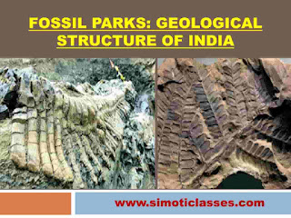

1. Shivalik Fossil Park (Saketi, Sirmaur district, Himachal Pradesh):

  • It has size models of vertebrates that might have inhabited Shivalik Hills, about 1.5 to 2.5 million years ago.
  • It covers an area of about 1.5 km2 in the Markanda valley of Sirmaur. This park was built to put a check on the destruction of fossil bones. This site has been developed to a panorama of the Pilo-Pleistocene period (2.5 million years) through large afforestation.

2.  Mandla Plant Fossils National Parks (Dindori, Madhya Pradesh):

  • This national park preserves the fossil remains of primordial forest about 40-150 million years ago.
  • The total area of the park is o.25 km2 which is spread over seven (7) villages of Dindori district namely- Ghuguwa, Umaria, Deorakhurd, Barbaspur, Chanti Hills, Chargaon, and Deori Kohani.

3. Ghughua Fossil Parks (Madhya Pradesh):

  • The national park has a trove of plant fossils belonging to 31 genera of 18 plant families.
  • The fossils indicate life in the area about 65 million years ago.

4. Marine Gondwana Fossil Park, Manendragarh, Sarguja district, Chattisgarh

  • It has fossiliferous marine Permian rocks of Talchir formation dated 280-240 million years.
  • It has a spread of 1 km on the right bank of the Hasdeo river and Hashia Nala.

5. National Fossil Wood Park, Tiruvakkarai, Tamil Nadu

  • It has 200 fossil trees ranging in length from 3-15 m and up to 5 m in girth which are seen as lying horizontally embedded in the Cuddalore Sandstone of the Mio-Pliocene age about 20 million years ago. 
  • It covers an area of 1 Km2.
  • The longest specimen measures 13.4 m X 0.9 m. 
  • Scientists believe that these trees did not grow at that site but were transported there before they were permitted.

6. National Fossil Wood Park, Santhanur, Tamil Nadu

  • This wood park contains large trunks of petrified trees (conifers) of the Upper Cretaceous age (100 million years ago).
  • The fossilized tree trunk at Sathanaur measures over 18 m in length.

7. Akal Wood Fossil Park, Jaisalmer district, Rajasthan

  • The fossil of the wood found in this park reflects the warm and humid climate considering the sea some 180 million years ago.
  • It contains fossils of wooden logs (petrophyllum, ptyllophyllum, equisetitis species, and dicotyledonous wood and gastropod shells of the Lower Jurassic period) lying in random horizontal orientation.

8. Stromatolite Park, Bhojunda, Chittaurgarh, Rajasthan

  • Stromatolites are structures produced by blue-green algae. 
  • They are the result of the combination of life activity and sediment trapping ability of algae and the preying bacteria.
  • Their formation occurs in shallow water where the tides bring the floating sedimentary material and make it flow through carbonate particles. These are the impressions of the earliest life forms.

9. Stromatolite Park, Jharkhand, and Udaipur district, Rajasthan

  • It is the largest and rich in deposits of phosphorite.
  • This site preserves and provides shreds of evidence of early life on the earth.
  • The rocks phosphate occurs in dolomite limestone associated with stromatolites which have a bluish-grey appearance.

Statewise details of the geological heritage sites/ national geological monuments declared by the Geological Survey of India are given in the following table:

State

Geological Heritage Sites/ National Geological Monuments 

Andhra Pradesh 

Mangampeta, Cuddapah district, Chittor district, National geological arch, Tirumala hills, Erra Matti Dibbalu-Stable coastal red sediments, Vishakhapatnam, Bheemunipatnam.

Kerala 

Laterite near Angadipuram, Malappuram district, Varkala Cliff Section, Thiruvanathapuram district. 

Tamil Nadu 

Fossil wood near Tiruvakkarai, South Arcot district, National Fossil wood park, Sathanur, Perambalur district, Charnockite, St. Thomas Mount, Madras, Badlands of Karai formation with cretaceous fossils along with Karai, Perambalur district. 

Gujarat 

Sedimentary structures- Eddy Markings, Kadam Dam, Panchmahal district. 

Rajasthan

Sendra granite, Pali district, Stromatolite Park, Bhojunda, Chittorgarh district, Rajasthan, Akal wood fossil park, Jaisalmer district, Kishangarh Nepheline Syenite, Ajmer district, Welded Tuff, Jodhpur district, Malani Igneous Suite Contact, Jodhpur district, Great Boundary Fault at Sutar, Bundi district.

Maharashtra 

Lonar lake, Buldhana district. 

Chattisgarh

Lower Permian Marine bed, Manendragrah, Sarguja district.

Karnataka

Columnar Lava, St. Mary's island Udupi district, Peninsular Gneiss, Lalbagh, Bangalore, Pyroclastics and pillow lavas, Kolar Goldfields, Kolar district.

Himachal Pradesh

Siwalik Fossil Park, Saketi, Sirmaur.

Odisha 

Pillow lava in Iron ore belt at Nomira, Keonjhra district. 

Jharkhand

Plant fossil-bearing inter-trappean beds of Rajmahal formation, upper Gondwana sequence around Mandro, Sahibganj district.  

Nagaland 

Nagahill Ophiolite site near Pungro. 

Sikkim 

Stromatolite bearing Dolomite/Limestone of Buxa formation at Mamley near Namchi, South district. 

Source: Ministry of Mines, Government of India, 2016


Share:

Tuesday, August 31, 2021

The Coastal Plains: Physiography of India

The Coastal Plains

The Peninsular Plateau of India is flanked by narrow coastal plains of varied width from north to south, known as the West-Coastal Plains and the East-Coastal Plains. These coastal plains differ from each other. They were formed by the depositional action of the rivers and the erosional and depositional actions of the sea waves.

According to geologists, the origin of the western and eastern coasts of India may be attributed to the faulting and subsidence of the Arabian Sea and the Bay of Bengal towards the close of the Eocene Period. Considering, the alluvial deposits along these coasts are of very recent origin, ranging from Pliocene to recent times. These coastal plains have evidence of submergence and emergence.

The Coastal Plains: Physiography of India

The Indian coastal plains may be subdivided into the following three (3) divisions;

1. The Gujarat Coastal Plains:

  • The Gujarat plain covers almost the entire state of Gujarat, except the district of Banaskantha and Sabarkantha.
  • It is formed by the alluvial deposits of Sabarmati, Mahi, Luni, and numerous tiny parallel consequent streams.
  • It contains the Gondwana rocks (Umia series), resting over the marine Jurassic rock and capped by Lower Cretaceous (Aptian) beds. The Deccan lava lies over the Umia series.

The eastern section of Gujarat Plain is a projected jet of the Sindhu-Ganga alluvial tract in Peninsular India. This projection is the outcome of extensive Pleistocene sedimentation. Present rivers have further advanced this deposition to the Gulf of Khambat. 

Among the highlands, mention may be made of;

  • Rajpipla Hills (Satpura)-famous for agate quarries
  • Parnera Hills in Bulsar district
  • Sahyadris in the southern side and 
  • Igneous complex of the Girnar Hills (Gorakhnath Peak, 1117 m)
  • Mandav Hills in Kathiwad.

The Rann of Katch is an extensive tact of naked tidal mudflats transected by abandoned and live creeks. The Gulf of Katch separates the Rann of Katch from the Kathiawar Peninsula. The salt in the soil makes this low-lying marshy area almost barren and unproductive. The whitish vertebrae of salts appear as white bony structures of the dried creeks. Live creeks from the dendritic pattern of drainage and there has been accentuation in this pattern due to earthquakes. South of the Rann lies Katch, formerly an island, which is almost surrounded by the Rann except in the south-west.


2. The West Coastal Plains:

  • It lies between the Sahyadris and the Arabian Sea. It is about 1400 km long and 10-80 km wide. 
  • It has an elevation up to 150 m above sea level, reaching more than 300 m at places.
  • The western coastal plain is characterized mainly by sandy beaches, coastal sand-dunes, mud-flats, lagoons, alluvial tracts along rivers, estuary, laterite platforms, and residual hills.
  • The Sahyadris (elevation 750-1225 m) runs parallel to the plain and present their steep face to the low lands with Thalghaat and Borghat (gaps) in the north and the Palghat (Palakkad gap) in the south of the Nilgiri.
  • Southwards is the Karnataka coastal plain which is about 525 km long and 8-25 km wide. It is the narrowest part of the west coastal plain. 
  • The southern part is known as the Malabar coast is found in the valleys of Beypore, the Ponnani (draining through Palghat), the Periyar, and Pamba Achankovil rivers. The coast is characterized by sand dunes. 

Along the coast, there are numerous shallow lagoons and backwaters- Kayaks and Teris. These lagoons are linked together to facilitate navigation through small boats. Here, Vembanad and Asthamudi are important lagoons of the Malabar coast. It is the homeland of aquatic life like crabs, frogs, mudskippers, birds like terns, kingfishers, cormorants, and otters and turtles live alongside the backwaters. 

The backwaters are important tourist spots and are of importance for transportation, fishing, and even agriculture. The region has deposits of Monazite sands which are reddish-brown and rich in phosphate. Monazite is radioactive due to the presence of thorium.


3. The East Coastal Plains: 

  • The eastern coastal plain lies between the Eastern Ghats and the Bay of Bengal and stretches along the coasts of Odisha, Andhra Pradesh, and Tamil Nadu. 
  • These plains are formed by the alluvial fillings of the littoral zone comprising some of the largest deltas of the world.
  • The east-coast plain consists mainly of recent and tertiary alluvial deposits. These are gentle, monotonous plains rinsing gently westward to the foot of the Eastern Ghats. The monotony of the topography is broken by the presence of numerous hills. 
  • This coastal plain has a straight shoreline with well-defined beaches of sand shingles. The most famous is Marina Beach (Chennai). 

There are some of the important lagoons of India along the Eastern coast, of which, Chilka lake in the southwest of the Mahanadi delta is the biggest lake (area= 65 km X 8 km) in the country. The Kulleru lake lies between the deltas of Godavari and Krishna while the Pulicat lake lies further south on the border of Andhra Pradesh and Tamil Nadu.

Previous Page:Forest Conservation: Geography- JPSC/ JSSC

Next Page:Fossil Parks: Geological Structure of India

Share:

Monday, August 30, 2021

Forest Conservation: Geography- JPSC/ JSSC

Forest Conservation

The unity of forests, their social relevance, and climatic importance have been discussed in the proceedings paras. The conservation of forest resources is imperative for our survival. Some of the steps which can go a long way in making forests healthy and sustainable are as under:


Forest Conservation: Geography- JPSC/ JSSC


  • Afforestation: There should be massive afforestation programs with the main emphasis being on the production of fuel-wood, timber, grasses, and small trees to cover up degraded and denuded lands.
  • Plantation and trees along the roads, railway lines, rivers, and canal banks, and along lakes and ponds.
  • Development of Green-belts in the urban areas and plantation of trees on community lands.
  • Villagers should be given loans at easy interest rates to revive degraded forests.
  • Encroachment of agriculture in forests should not be allowed to exceed the carrying capacity of the forests.
  • The development projects including mining and industrial activities should be so planned to cause minimum damage to forest ecosystems.
  • Mining contracts should have an obligatory clause of reforestation when the process of mining is over.
  • Industries should adopt anti-pollution devices and must develop and compensate for the forest loss by new plantations.
  • Shifting cultivation should be gradually replaced by terraced farming and orchards development and silviculture.
  • Scientific methods should be adopted to check and contain forest fires. There should be strict control in issuing licenses for the establishment of industries in forest areas.
  • There should be more research on forestry in agricultural universities, for which facilities and funds should be provided by the Central and State governments. Forestry should be made an important part of the course structures in schools, colleges, and universities. 
  • There should be perfect coordination between the forest department and other departments of the government for effective and judicious utilization of forests and their conservation.
  • People should be encouraged to participate in the Van-Mahotsav and should be made aware of the Chipko Movement.
  • There is a need to change our outlook on forests. A forest should not be treated as a perennial resource and a source of revenue only. The planning and conservation of forests is not only the duty of the government but also all the citizens of the country.
  • There should be special audio-visual programs, demonstrations, seminars, and workshops to develop awareness among the people about the social relevance of forests.

The Indian Council of Forestry Research and Education (ICFRE) was created in 1987 under the Ministry of Environment and Forests.

The following forestry research institutes are working under the Indian Council of Forestry Research and Education:

  • Forest Survey of India, Dehra Dun.
  • The Central Arid Zone Research Institute, Jodhpur.
  • The Institute of Rain and Moist Deciduous Forests, Jorhat.
  • The Institute of Wood Science and Technology, Bangalore.
  • The Tropical Forestry Research Institute, Jabalpur.
  • The Himalayan Forest Research Center, Shimla.
  • The Center for Forest Productivity, Ranchi.
  • The Center for Social Forestry and Environment, Allahabad.
  • Institute of Forest Productivity, Hyderabad.
  • Centre for Social Forestry and Eco Rehabilitation, Allahabad.
  • Centre for Forest-based livelihoods and extension, Agartala.
  • Directorate of Forest Education, Dehradun.

Previous Page:Western Ghats: A World Heritage Site: Geography- JPSC/ JSSC

Next Page:The Coastal Plains: Physiography of India

Share:

Western Ghats: A World Heritage Site: Geography- JPSC/ JSSC

Western Ghats: A World Heritage Site

The Coorg or Kodagu is a part of the Western Ghats that has been included in the UNESCO World Heritage List in the meeting of the World Heritage Committee held at St. Petersburg's (Russia) on 1st July 2012.

Western Ghats: A World Heritage Site: Geography- JPSC/ JSSC

The Westen Ghat has outstanding examples of representing significant ongoing ecological and biological processes in the evolution and development of terrestrial, freshwater, coastal, and marine ecosystems and communities of plants and animals. It is also the most significant natural habitat for in-situ conservation of biological diversity, including those containing threatened species of outstanding universal value from the point of view of science and conservation. Apart from the World Heritage Site, it is one of the most eight (8) hottest hotspots of biological diversity in the world. The Ecologically Sensitive Area (ESA) in 56,825 Km2 (2014).

The Western Ghat or the Sahyadri is a mountain range of Peninsular India. It separates the Deccan Plateau from the narrow coastal plain along the Arabian Sea.

The Western Ghats starts south of the Tapi river in Gujarat and runs about 1600 km through the six (6) states of Gujarat, Maharashtra, Goa, Karnataka, Tamil Nadu, Kerala ending at the Kanyakumari at the southern tip of India.


The main peaks of the Western Ghats are:

  • Anaimudi (2695 m)
  • Doddabetta (2636 m)
  • Mukurthi (2554 m)
  • Kodaikanal (2133 m)
  • Bababudangiri (1895 m)
  • Kudremukh (1894 m)
  • Agasthymalai (1866 m)
  • Pushpagiri (1712 m)
  • Kalsubai (1646 m)
  • Salher (1567 m)

The important hill stations are located in the Western Ghats:

  • Ooty (2500 m)
  • Kodaikanal (2285 m)

The area has 5000 species of flowering plants, 139 mammal species, 508 bird species, and 179 amphibian species. According to one estimate 325, globally threatened species occur in the Western Ghats.

The Western Ghats are covered with tropical and subtropical forests that provide food and natural habitats for the native tribal people. The area is ecologically sensitive to development.

The Government of India has established many protected areas including 2 biosphere reserves (BRs), 13 National Parks, and several wildlife sanctuaries to protect specific endangered species. 

  • Nilgiri Biosphere Reserves (5500 Km2) of the evergreen forests of Nagarhole.
  • Bandipur National Parks are covered with deciduous forest.
  • Mukurthi National Parks in the states of Kerala and Tamil Nadu are the protected areas.

Moreover, there are Mudumalai (Coimbatore), Anamalai (Nilgiri District), and Munda Thurai (Tirunelveli and Kanniyakumari districts) tiger reserves in the southern parts of the Western Ghats.

Judicious use of resources and conservation practices can improve the resilience characteristics of the ecosystems of this important world heritage site.

Previous Page:Dharwar System (Proterozoic Formations): Geological Structure of India

Next Page:Forest Conservation: Geography- JPSC/ JSSC


Share:

Dharwar System (Proterozoic Formations): Geological Structure of India

Dharwar System (Proterozoic Formations)

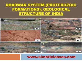
The geologic time extends from 2500 million years ago to 1800 million years ago. These are the first metamorphosed sedimentary rock systems known as the Dharwar System in the Indian Geological Time Scale, as they were studied for the first time in the Dharwar district of Karnataka. 

They are composed largely of igneous debris, schists, and gneisses. 


Dharwar System (Proterozoic Formations): Geological Structure of India

The Dharwar rocks occur in scattered patches in;

  • Dharwar and Bellary districts of Karnataka and extends up to Nilgiris and Madurai districts of Tamil Nadu.
  • The Aravallis, Rialo (Delhi series) from Delhi to the South of Alwar and the Himalayan region.

The Dharwar rocks are rich in minerals like iron ore, manganese, lead, zinc, gold, silver, dolomite, mica, copper, tungsten, nickel, precious stones, and building materials.


Some of the important series of the Dharwar System are:

Name of the series of Dharwar System

Distribution in India

Significant Features

Champion Series

1. NE of Mysore city to the east of Bangalore.

2. It stretches in the Kolar and Raichur districts of Karnataka.

1. One of the deepest gold mines in the world.

2. Depth= >3.5 Km.

3. Gold content= 5.5 per tonne of the ore.

4. Headquarters of the National Institute of Miner's Health is located here.

Champaner Series

1. Lies in the outlier of the Aravalli system in the vicinity of Vadodara.

1. Minerals: Quartzites, conglomerates, phyllites, slates, limestones, and marbles.

2. Popular for the green variety of marble.

Chilpi Series

1. Occupies parts of Balaghat, Jabalpur, and Chindwara districts of Madhya Pradesh.

1. Minerals: grit, phyllite, quartzites, green stones, magniferous rocks.

Closepet Series

1. Distributed in Balaghat and Chhindwara districts of Madhya Pradesh.

1. It is the Dharwaian formation.

2. Minerals found: quartzite, copper pyrite, magniferous rocks.

3. Ore supplied to the Malanjhand Copper plant.

Iron Ore Series

1. Distributed in Singhbhum, Bonai, Mayubhanj, Keonjhar in the form of a range.1. It is about 65 km in length has reserves of about 3000 million tonnes of iron ore.

2. Iron ore is supplied to Jamshedpur, Durgapur, Rourkela, and Bokaro Steel plants.
Khondolite Series

1. Occupies large area in the eastern Ghats from the northern extremity to Krishna valley.

1. Principal rock types: khondlites, kodurites, charnockites, gneisses.

Rialo Series (Delhi Series)

1. Extends from Delhi (Majnu ka Tila) to Alwar (Rajsthan in the northeast to southwest direction).

1. Rich in limestone and Makrana marbles.

2. Makrana and Bhagwanpur are known for their high quality of marbles.

Sakoli Series 

1. Stretches over Jabalpur and Rewa districts

1. Series belongs to the Dharwian formation.

2. Rich in mica, dolomite, schist, and marble (Superiormost quality). 

Sausar Series 

1. Series spreads over Nagpur and Bhandara districts of Maharashtra and Chhindwara district of Madhya Pradesh.

1. It belongs to the Dharwarian group.

2. Minerals found: mica schist, quartzite, marble, and magniferous rocks.

Previous Page:Urbanization (Section- H): JPSC 

Next Page:Western Ghats: A World Heritage Site: Geography- JPSC/ JSSC

Share:

Unordered List

Search This Blog

Powered by Blogger.

About Me

My photo
Education marks proper humanity.

Text Widget

Featured Posts

Popular Posts